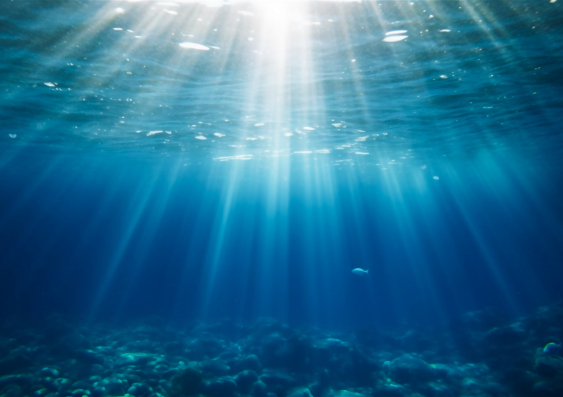
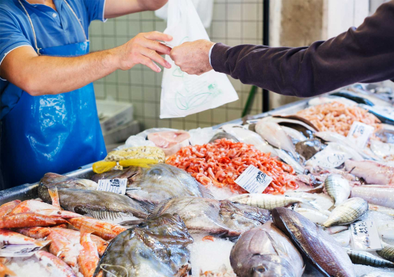
A scientist from UNSW Sydney is spearheading a program to crowdsource ocean data from understudied areas.
A group of scientists, including a team at UNSW, are working with Australia’s commercial fishing industry to gather invaluable ocean observations. Since its inception, the has collected more than 2.8 million data points below the ocean’s surface.
“While the ocean environment that Australia is responsible for is one of the largest in the world, the ocean temperature data that we have is mostly concentrated in surface waters or the very narrow edges around the country, adjacent to our bigger cities, with only sparse deep measurements.” says Prof. Moninya Roughan, an oceanographer from UNSW.
This has left us with huge gaps in our ability to understand ocean dynamics and warming where it matters most.
To address this ongoing issue, Prof. Roughan, from the School of Biological, Earth & Environmental Science, has co-designed a built-for-purpose ocean sensor that can be attached to fishing gear on commercial vessels to collect ocean temperatures. Â
After establishing a hugely successful program in Aotearoa New Zealand, Prof. Roughan teamed up with Dr Ian Knuckey from to launch a similar program in Australia – funded by the , and Australia’s – working alongside a vast network of fishing industry collaborators.
“We’re essentially turning fishing boats into oceanographic research vessels,” she says. “We have co-designed a fully automatic system that measures, processes, and delivers temperature observations in near real-time with the goal of providing broad-scale coverage of Australia and New Zealand’s coastal waters.
“The impact of this newly gathered data is huge, from improving fishing capabilities, to better understanding the impact of marine heatwaves and improvements to ocean models.”Â
This project also aims to support fisheries and drive a sustainable seafood sector by assisting informed decision-making, reducing the cost of operations and increasing resilience. “Fishing smarter, not harder,” says Prof. Roughan.Â
Media enquiries
For enquiries about this story and to arrange interviews please contact Melissa Lyne.
Tel: 0415 514 328
Email: m.lyne@unsw.edu.au
The Moana Project
Between 2017 and 2020, Prof. Roughan led a program based in Aotearoa New Zealand to develop a nationwide subsurface temperature monitoring program that was funded by the Ministry of Business, Innovation and Employment, following commercial losses in the fishing industry.
“These losses were believed to be related to ocean warming and marine heatwaves, but there was no data to truly understand what was going on,” says Prof. Roughan.Â
set out to develop a sensor that was fit for purpose, lightweight, solar-powered, and required no human intervention. The sensor was developed and built by the technology partner ZebraTech. “The sensor goes on the fishing gear – such as nets, pots, traps and lines – it collects its information on ocean temperature and once back on deck, transmits the data into our database via satellite,” says Prof. Roughan.
“We also designed the system so that we email the data directly back to the fishers and we integrate the data into our ocean models.”
The project has been a huge success. In the first two years alone, more than 300 sensors were deployed onto over 200 vessels with the cooperation and support of the commercial fishing sector, providing more than 1 million temperature measurements per month throughout New Zealand’s marine jurisdiction.
Importantly, the sensors are installed on a range of fishing vessels, from scallop dredges and tuna long liners, to lobster boats and prawn trawlers, all which fish with different techniques and at varying ocean depths below the surface. “Each day, these fishing gears are deployed from the surface to the seafloor, providing a wealth of information on the entire water column.
“We also worked with Iwi, Traditional Owners in New Zealand, to gather ocean data from remote areas where people were fishing,” says Prof. Roughan. The team at the Moana Project recently published a paper in the journal summarising the successes and lessons learned from their partnership. These insights are proving invaluable for developing the Australian project – FishSOOP – and beyond.
Collaborating with the fishing industry in Australia
Australia’s marine jurisdiction is nearly twice the surface area of the Australian land mass. Covering an expansive , it is the third largest marine jurisdiction on Earth.Â
To begin with, the Australian FishSOOP program deployed sensors on 17 vessels across the southeast, but it has been expanding steadily ever since, to nearly 40 vessels in just 12 months. To date, FishSOOP has vessels instrumented with the sensors in all Australian states and territories apart from ACT.Â
"Since starting the pilot, colleagues at the University of The Sunshine Coast have got Tuna Australia involved, who have instrumented four vessels along the east coast,” says Prof. Roughan. "Collaborators on the project have also secured funding across the Northern Territory and northern NSW for Indigenous rangers to deploy the sensors when they go out on Sea Country.”Â
While the pilot is now in the process of wrapping up, IMOS will sustain the observing program as part of its Ships of Opportunity Facility, operated through an IMOS partner, the Sydney Institute of Marine Science, and led by Prof. Roughan.
A mutually beneficial partnership
The success of the research relies heavily on partnership and collaboration and centers on empowering the stakeholders involved with data and knowledge.Â
“It’s really important to recognise that everyone has something to contribute and brings value to the program,” says Prof. Roughan.Â
Feedback from participants involved in the project suggested that fishers can correlate the records of subsurface temperature with catch data to improve fishing quality.
“In February, I got an email from a skipper who had sent a satellite map of sea surface temperature. We then checked the data from a sensor on a tuna vessel and it had recorded 29 degrees down to 100 meters deep – the southern coast of Queensland was experiencing a marine heatwave,” says Prof. Roughan. “We were then able to track as the vessel responded by moving down the coast to south of Byron Bay, where the ocean temperature had reduced to 26 degrees.
"Ultimately, fish is a really important source of protein and is valuable for many communities, and we want to support fisheries to do their work efficiently with the least environmental impact, while contributing to marine stewardship.” Â
Using the data in ocean models
Ocean models, which are numerical representations of ocean properties and circulation, play a crucial role in understanding the ocean's impact on weather and climate, but also their impact on fishing.Â
While technology exists to collect temperature data from deep waters, it is expensive and sparse, leaving us with a huge knowledge gap regarding subsurface ocean temperatures – ranging from just below the surface to 1000 meters deep. This depth-related information is crucial for the fishing sector and encompasses most of the Australian fishing effort. The subsurface ocean also plays a vital role in ocean dynamics, including on the continental shelf.
For Prof. Roughan, her research focuses on the point in the ocean depth where the temperature changes most rapidly, known as the thermocline. “Our ocean models don't capture the thermocline very well, and we're researching how to get the models to better capture this,” she says.Â
In fact, the structure of marine heatwaves below the surface of the ocean is poorly understood and the data collected as part of these projects could provide unprecedented detail.Â
Dr Colette Kerry, a Postdoc at UNSW working with Prof. Roughan, recently led a study published in the journal that revealed how subsurface ocean temperatures, collected from the sensors deployed through the Moana project, could be used in ocean models to significantly improve our estimates of both bottom and upper ocean temperatures.
Building an international community of practice
The teams working on crowdsourcing ocean temperature have made huge progress in the years since the Moana project was first launched.Â
Overall, the schemes across Australia and New Zealand have provided ocean temperature data from regions that were previously unobserved. “As well as expanding the data along the continental shelf, we're getting out to remote parts of Australia that are hard to get to, but we know there are people out there already fishing,” says Prof. Roughan. “We’ve had seven fishing vessels across the top end of Australia where the sensors are collecting data. Having not travelled there myself, it's an extremely efficient and sustainable way to do ocean fieldwork. Â
“We’re only just getting started,” says Prof. Roughan. “We’re very focused on making the data open access, which is a requirement for IMOS. We also want to more effectively incorporate the data we have into ocean modelling, and our program has been endorsed by the UN Ocean Decade for Sustainable Development.”Â
The team is also investigating ways they can improve delivering the reports back to the fishers.Â
“At the moment, the data they receive is a static snapshot, it’s not layers of data that can be used to predict what might happen the next day – at the moment they are inferring that themselves. We're keen to work on more of a predictive model,” says Prof. Roughan.Â
Earlier this year, the work of the , which includes Prof. Roughan’s research, was endorsed by the Global Ocean Observing System as an emerging network, which means that the program is building a community of practice. The idea is that these methods can be used all over the globe. Â
“The problems of sparse ocean data that we see here are not unique to Australia,” says Prof. Roughan. “The international collaboration that is forming out of this project is really important, and the more we work together on a global scale, the faster we’re able to progress.”


